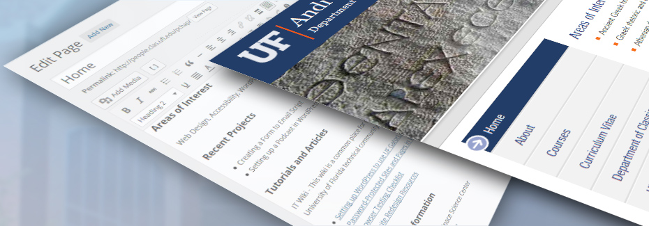
|
Linard, C., Gilbert, M., Snow, R.W., Noor, A.M. and Tatem, A.J., 2012, Population distribution, settlement patterns and accessibility across Africa in 2010, PLoS ONE, in press. The spatial distribution of populations and settlements across a country and their interconnectivity and accessibility from urban areas are important for delivering healthcare, distributing resources and economic development. However, existing spatially explicit population data across Africa are generally based on outdated, low resolution input demographic data, and provide insufficient detail to quantify rural settlement patterns and, thus, accurately measure population concentration and accessibility. Here we outline approaches to developing a new high resolution population distribution dataset for Africa and analyse rural accessibility to population centers. Contemporary population count data were combined with detailed satellite-derived settlement extents to map population distributions across Africa at a finer spatial resolution than ever before. Substantial heterogeneity in settlement patterns, population concentration and spatial accessibility to major population centres is exhibited across the continent. In Africa, 90% of the population is concentrated in less than 21% of the land surface and the average per-person travel time to settlements of more than 50,000 inhabitants is around 3.5 hours, with Central and East Africa displaying the longest average travel times. The analyses highlight large inequities in access, the isolation of many rural populations and the challenges that exist between countries and regions in providing access to services. The datasets presented are freely available as part of the AfriPop project, providing an evidence base for guiding strategic decisions.
Tatem, A.J. and Linard, C., 2011, Population mapping of poor countries, Nature, 474, 36. Global population maps can be valuable for quantifying populations at risk, such as those near nuclear power plants (Nature 472, 400–401; 2011). But the uncertainties inherent in such data sets must be acknowledged. The census data used in map construction for rich countries are recent and detailed. The same is often not true for poorer countries. For example, Angola’s last census was in 1970, broken down into just 18 districts. Estimates of its current total resident population vary from 13.3 million to 19 million, according to the US Census Bureau and the United Nations, respectively. When such outdated and coarse-resolution data are subject to different modelling assumptions by different groups, it can lead to substantially divergent estimates of population distributions and, consequently, populations at risk. Uncertainties in and between global population maps should be more widely discussed, and a greater effort made to quantify them. Furthermore, spatially referenced demographic data used in map construction are often scattered across national statistical offices and websites. A centralized, open-access, up-to-date database would benefit many fields that rely on population maps, and would require minimal investment. PAPER
Tatem, A.J., Campiz, N., Gething, P.W., Snow, R.W. and Linard, C., 2011, The effects of spatial population dataset choice on population at risk of disease estimates, Population Health Metrics, 9: 4. Background: The spatial modeling of infectious disease distributions and dynamics is increasingly being undertaken for health services planning and disease control monitoring, implementation, and evaluation. Where risks are heterogeneous in space or dependent on person-to-person transmission, spatial data on human population distributions are required to estimate infectious disease risks, burdens, and dynamics. Several different modeled human population distribution datasets are available and widely used, but the disparities among them and the implications for enumerating disease burdens and populations at risk have not been considered systematically. Here, we quantify some of these effects using global estimates of populations at risk (PAR) of P. falciparum malaria as an example. Methods: The recent construction of a global map of P. falciparum malaria endemicity enabled the testing of different gridded population datasets for providing estimates of PAR by endemicity class. The estimated population numbers within each class were calculated for each country using four different global gridded human population datasets: GRUMP (~1km spatial resolution), LandScan (~1km), UNEP Global Population Databases (~5km), and GPW3 (~5km). More detailed assessments of PAR variation and accuracy were conducted for three African countries where census data were available at a higher administrative-unit level than used by any of the four gridded population datasets. Results: The estimates of PAR based on the datasets varied by more than 10 million people for some countries, even accounting for the fact that estimates of population totals made by different agencies are used to correct national totals in these datasets and can vary by more than 5% for many low-income countries. In many cases, these variations in PAR estimates comprised more than 10% of the total national population. The detailed country-level assessments suggested that none of the datasets was consistently more accurate than the others in estimating PAR. The sizes of such differences among modeled human populations were related to variations in the methods, input resolution, and date of the census data underlying each dataset. Data quality varied from country to country within the spatial population datasets. Conclusions: Detailed, highly spatially resolved human population data are an essential resource for planning health service delivery for disease control, for the spatial modeling of epidemics, and for decision-making processes related to public health. However, our results highlight that for the low-income regions of the world where disease burden is greatest, existing datasets display substantial variations in estimated population distributions, resulting in uncertainty in disease assessments that utilize them. Increased efforts are required to gather contemporary and spatially detailed demographic data to reduce this uncertainty, particularly in Africa, and to develop population distribution modeling methods that match the rigor, sophistication, and ability to handle uncertainty of contemporary disease mapping and spread modeling. In the meantime, studies that utilize a particular spatial population dataset need to acknowledge the uncertainties inherent within them and consider how the methods and data that comprise each will affect conclusions. PAPER
Linard, C., Alegana, V.A., Noor, A.M., Snow, R.W. and Tatem, A.J., 2010, A high resolution spatial population database of Somalia for disease risk mapping, International Journal of Health Geographics, 9: 45. Background: Millions of Somali have been deprived of basic health services due to the unstable political situation of their country. Attempts are being made to reconstruct the health sector, in particular to estimate the extent of infectious disease burden. However, any approach that requires the use of modelled disease rates requires reasonable information on population distribution. In a low-income country such as Somalia, population data are lacking, are of poor quality, or become outdated rapidly. Modelling methods are therefore needed for the production of contemporary and spatially detailed population data. Results: Here land cover information derived from satellite imagery and existing settlement point datasets were used for the spatial reallocation of populations within census units. We used simple and semi-automated methods that can be implemented with free image processing software to produce an easily updatable gridded population dataset at 100 x 100 meters spatial resolution. The 2010 population dataset was matched to administrative population totals projected by the UN. Comparison tests between the new dataset and existing population datasets revealed important differences in population size distributions, and in population at risk of malaria estimates. These differences are particularly important in more densely populated areas and strongly depend on the settlement data used in the modelling approach. Conclusions: The results show that it is possible to produce detailed, contemporary and easily updatable settlement and population distribution datasets of Somalia using existing data. The 2010 population dataset produced is freely available as a product of the AfriPop Project and can be downloaded from: www.afripop.org. PAPER
Linard, C., Gilbert, M. and Tatem A.J., 2010, Assessing the use of global land cover data for guiding large area population distribution modelling, Geojournal, doi:10.1007/s10708-010-9364-8. Gridded population distribution data are finding increasing use in a wide range of fields, including resource allocation, disease burden estimation and climate change impact assessment. Land cover information can be used in combination with detailed settlement extents to redistribute aggregated census counts to improve the accuracy of national-scale gridded population data. In East Africa, such analyses have been done using regional land cover data, thus restricting application of the approach to this region. If gridded population data are to be improved across Africa, an alternative, consistent and comparable source of land cover data is required. Here these analyses were repeated for Kenya using four continent-wide land cover datasets combined with detailed settlement extents and accuracies were assessed against detailed census data. The aim was to identify the large areas land cover dataset that, combined with detailed settlement extents, produce the most accurate population distribution data. The effectiveness of the population distribution modelling procedures in the absence of high resolution census data was evaluated, as was the extrapolation ability of population densities between different regions. Results showed that the use of the GlobCover dataset refined with detailed settlement extents provided significantly more accurate gridded population data compared to the use of refined AVHRR-derived, MODIS-derived and GLC2000 land cover datasets. This study supports the hypothesis that land cover information is important for improving population distribution model accuracies, particularly in countries where only coarse resolution census data are available. Obtaining high resolution census data must however remain the priority. With its higher spatial resolution and its more recent data acquisition, the GlobCover dataset was found as the most valuable resource to use in combination with detailed settlement extents for the production of gridded population datasets across large areas. PAPER
Tatem, A.J. and Smith, D.L., 2010, International population movements and regional Plasmodium falciparum malaria elimination strategies, Proceedings of the National Academy of Sciences, 107: 24. Calls for the eradication of malaria require the development of global and regional strategies based on a strong and consistent evidence base. Evidence from the previous global malaria eradication program and more recent transborder control campaigns have shown the importance of accounting for human movement in introducing infections to areas targeted for elimination. Here, census-based migration data were analysed with network analysis tools, P. falciparum malaria transmission maps and global population databases to map globally communities of countries linked by relatively high levels of infection movements. The likely principal sources and destinations of imported cases in each region were also mapped. Results indicate that certain groups of countries, such as those in West Africa and central Asia are much more strongly connected by relatively high levels of population and infection movement than others. In contrast, countries such as Ethiopia and Myanmar display significantly greater isolation in terms of likely infection movements in and out. The mapping here of both communities of countries linked by likely higher levels of infection movement, and ‘natural’ migration boundaries that display reduced movement of people and infections between regions has practical utility. These can inform the design of malaria elimination strategies by identifying regional communities of countries afforded protection from re-colonisation by surrounding regions of reduced migration. For more isolated countries, a nationally-focussed control or elimination program is likely to stand a better chance of success than those receiving high levels of visitors and migrants from high transmission regions. PAPER
Snow RW, Alegana VA, Okiro EA, Gething PW, Patil P, Tatem A.J., Linard C, Moloney G, Borle M, Yusuf FE, Amran J, Noor AM. Estimating the Plasmodium falciparum morbidity and mortality burden 2005 and 2009 in Somalia: Combining models of population distribution, time-space changes in malaria infection risk and the epidemiology of malaria disease burden. Report prepared for UNICEF-Somalia, March 2010. To effectively guide malaria control and understand how interventions impact on transmission of the parasite it is important to map where people live in relation to the intensity of malaria transmission. We developed a model of human population settlement interpolated across space to define the distributions of people at risk of malaria. We used parasite prevalence data assembled from 1657 community surveys to spatially model the distribution of malaria risk at 1x1 km resolutions. This model showed a good correlation between predicted and observed estimates of infection in a withheld test data set (2005-07: R2 = 0.76; Mean error = -2.7%; 2008-09: R2 = 0.71; Mean error = -3.1%). We the created three strata of malaria risk that related to disease epidemiology. Following a search for malaria-specific incidence data on clinical attacks and direct causes of death due to Plasmodium falciparum we estimated the median estimates (and ranges) of disease outcome under the three transmission strata. Using the combined models of population, infection and disease outcome we have estimated that in 2005 there may have been approximately 1.73 million clinical attacks of P. falciparum malaria according to the modeled malaria endemicity and population projections during this period. At the end of the period 2008-2009 populations exposed to high transmission had decreased dramatically; consequently the modeled predictions of the number of clinical attacks in 2009 was 57% lower than 2005 with approximately 740,000 clinical cases and a 67% reduction in malaria-specific mortality to approximately 7,460 deaths. The majority of transmission intensity change between 2005 and 2009 occurred in South Central Somalia. Whether the small incremental increase in insecticide treated net coverage (2005: 7% -2009: 22%) and increased investment in disease management were responsible for this change or changes in rainfall were responsible remains uncertain. The models however provide an opportunity to explore these plausibility arguments in more detail. Interestingly we compared other possible models of morbidity estimation using incomplete health information systems and assuming a fixed rate of non-presentation to the formal health facilities in Somalia and predicted a morbidity burden of 630,000 cases in 2009. While lower than the epidemiological model approach both approaches are within a presumed margin of uncertainty and these comparative approaches deserve further attention.
Tatem, A.J., Guerra, C.A., Kabaria, C.W., Noor, A.M., Hay, S.I. Human population, urban settlement patterns and their impact on Plasmodium falciparum malaria endemicity. Malaria Journal, 2008. 7:218.
BACKGROUND: The efficient allocation of financial resources for malaria control and the optimal distribution of appropriate interventions require accurate information on the geographic distribution of malaria risk and of the human populations it affects. Low population densities in rural areas and high population densities in urban areas can influence malaria transmission substantially. Here, the Malaria Atlas Project (MAP) global database of Plasmodium falciparum parasite rate (PfPR) surveys, medical intelligence and contemporary population surfaces are utilized to explore these relationships and other issues involved in combining malaria risk maps with those of human population distribution in order to define populations at risk more accurately. METHODS: First, an existing population surface was examined to determine if it was sufficiently detailed to be used reliably as a mask to identify areas of very low and very high population density as malaria free regions. Second, the potential of international travel and health guidelines (ITHGs) for identifying malaria free cities was examined. Third, the differences in PfPR values between surveys conducted in author defined rural and urban areas were examined. Fourth, the ability of various global urban extent maps to reliably discriminate these author-based classifications of urban and rural in the PfPR database was investigated. Finally, the urban map that most accurately replicated the author-based classifications was analysed to examine the effects of urban classifications on PfPR values across the entire MAP database. RESULTS: Masks of zero population density excluded many non-zero PfPR surveys, indicating that the population surface was not detailed enough to define areas of zero transmission resulting from low population densities. In contrast, the ITHGs enabled the identification and mapping of 53 malaria free urban areas within endemic countries. Comparison of PfPR survey results showed significant differences between author-defined urban and rural designations in Africa, but not for the remainder of the malaria endemic world. The Global Rural Urban Mapping Project (GRUMP) urban extent mask proved most accurate for mapping these author-defined rural and urban locations, and further sub-divisions of urban extents into urban and peri-urban classes enabled the effects of high population densities on malaria transmission to be mapped and quantified. CONCLUSION: The availability of detailed, contemporary census and urban extent data for the construction of coherent and accurate global spatial population databases is often poor. These known sources of uncertainty in population surfaces and urban maps have the potential to be incorporated into future malaria burden estimates. Currently, insufficient spatial information exists globally to identify areas accurately where population density is low enough to impact upon transmission. Medical intelligence does however exist to reliably identify malaria free cities. Moreover, in Africa, urban areas that have a significant effect on malaria transmission can be mapped. PDF
Tatem, A.J., Noor, A.M., von Hagen, C., Di Gregorio, A., and S.I. Hay, High resolution settlement and population maps for low income nations: combining land cover and national census in East Africa. PLoS One, 2007. 2: p. e1298.
BACKGROUND: Between 2005 and 2050, the human population is forecast to grow by 2.7 billion, with the vast majority of this growth occurring in low income countries. This growth is likely to have significant social, economic and environmental impacts, and make the achievement of international development goals more difficult. The measurement, monitoring and potential mitigation of these impacts require high resolution, contemporary data on human population distributions. In low income countries, however, where the changes will be concentrated, the least information on the distribution of population exists. In this paper we investigate whether satellite imagery in combination with land cover information and census data can be used to create inexpensive, high resolution and easily-updatable settlement and population distribution maps over large areas. METHODOLOGY/PRINCIPAL FINDINGS: We examine various approaches for the production of maps of the East African region (Kenya, Uganda, Burundi, Rwanda and Tanzania) and where fine resolution census data exists, test the accuracies of map production approaches and existing population distribution products. The results show that combining high resolution census, settlement and land cover information is important in producing accurate population distribution maps. CONCLUSIONS: We find that this semi-automated population distribution mapping at unprecedented spatial resolution produces more accurate results than existing products and can be undertaken for as little as $0.01 per km2. The resulting population maps are a product of the Malaria Atlas Project (MAP: http://www.map.ox.ac.uk) and are freely available. PDF
Tatem, A.J., Noor, A.M. and S.I. Hay, Assessing the accuracy of satellite derived global and national urban maps in Kenya. Remote Sensing of Environment, 2005. 96: p. 87-97.
Ninety percent of projected global urbanization will be concentrated in low income countries. This will have considerable environmental, economic and public health implications for those populations. Objective and efficient methods of delineating urban extent are a cross-sectoral need complicated by a diversity of urban definition rubrics world-wide. Large-area maps of urban extents are becoming increasingly available in the public domain, as are a wide-range of medium spatial resolution satellite imagery. Here we describe the extension of a methodology based on Landsat ETM and Radarsat imagery to the production of a human settlement map of Kenya. This map was then compared with five satellite imagery-derived, global maps of urban extent at Kenya national-level, against an expert opinion coverage for accuracy assessment. The results showed the map produced using medium spatial resolution satellite imagery was of comparable accuracy to the expert opinion coverage. The five global urban maps exhibited a range of inaccuracies, emphasising that care should be taken with use of these maps at national and sub-national scale.
S.I. Hay, Noor, A.M., Nelson, A. And Tatem, A.J., The accuracy of human population maps for public health application. Tropical Medicine and International Health, 2005. 10: p. 1073-1086.
OBJECTIVES: Human population totals are used for generating burden of disease estimates at global, continental and national scales to help guide priority setting in international health financing. These exercises should be aware of the accuracy of the demographic information used. METHODS: The analysis presented in this paper tests the accuracy of five large-area, public-domain human population distribution data maps against high spatial resolution population census data enumerated in Kenya in 1999. We illustrate the epidemiological significance, by assessing the impact of using these different human population surfaces in determining populations at risk of various levels of climate suitability for malaria transmission. We also describe how areal weighting, pycnophylactic interpolation and accessibility potential interpolation techniques can be used to generate novel human population distribution surfaces from local census information and evaluate to what accuracy this can be achieved. RESULTS: We demonstrate which human population distribution surface performed best and which population interpolation techniques generated the most accurate bespoke distributions. Despite various levels of modelling complexity, the accuracy achieved by the different surfaces was primarily determined by the spatial resolution of the input population data. The simplest technique of areal weighting performed best. CONCLUSIONS: Differences in estimates of populations at risk of malaria in Kenya of over 1 million persons can be generated by the choice of surface, highlighting the importance of these considerations in deriving per capita health metrics in public health. Despite focussing on Kenya the results of these analyses have general application and are discussed in this wider context.
Tatem, A.J., Noor, A.M. and S.I. Hay, Defining approaches to settlement mapping for public health management in Kenya using medium spatial resolution satellite imagery. Remote Sensing of Environment, 2004. 93: p. 42-52.
This paper presents an appraisal of satellite imagery types and texture measures for identifying and delineating settlements in four Districts of Kenya chosen to represent the variation in human ecology across the country. Landsat Thematic Mapper (TM) and Japanese Earth Resources Satellite-1 (JERS-1) synthetic aperture radar (SAR) imagery of the four districts were obtained and supervised per-pixel classifications of image combinations tested for their efficacy at settlement delineation. Additional data layers including human population census data, land cover, and locations of medical facilities, villages, schools and market centres were used for training site identification and validation. For each district, the most accurate approach was determined through the best correspondence with known settlement and nonsettlement pixels. The resulting settlement maps will be used in combination with census data to produce medium spatial resolution population maps for improved public health planning in Kenya.
Tatem, A.J. and S.I. Hay, Measuring Urbanization Pattern and Extent for Malaria Research: A Review of Remote Sensing Approaches. Journal of Urban Health, 2004. 81: p. 363-376.
Within the next 30 years, the proportion of urban dwellers will rise from under half to two thirds of the world’s population. Such a shift will entail massive public health consequences, and most of this urban transition will occur in low-income regions of the world. Urban populations face very different health risks compared to those in rural areas, particularly in terms of malaria. To target effective and relevant public health interventions, the need for clear, consistent definitions of what determines urban areas and urban communities is paramount. Decision makers are increasingly seeing remote sensing as a cost-effective solution to monitoring urbanization at a range of spatial scales. This review focuses on the progress made within the field of remote sensing on mapping, monitoring, and modeling urban environments and examines existing challenges, drawbacks, and future prospects. We conclude by exploring some of the particular relevance of these issues to malaria and note that they are of more general relevance to all those interested in urban public health. |


|
Home |
Project details |
|
Data |
Methods |
|
Publications |
Contact / Acknowledgements |